PHOENIX — After a cool and wet weekend, we are in for even more desert rain and high country snow.
LIVE: Track radar conditions across the Valley
Temperatures are staying cool, winds are cranking up, and rain and snow chances are going up as the last in a string of storms moves into our state.

The greatest impacts will continue to be across the high country where significant snowfall is expected Monday and Tuesday.
A Winter Storm Warning is now in effect for areas above 4,000 feet in northern, central, and southeastern Arizona through Tuesday.

Some areas have already picked up more than a foot of snow, and we could see an additional foot or more in our highest Arizona elevations on Monday and Tuesday.
As winds pick up, blowing and drifting snow will make for dangerous travel conditions across the high country through Tuesday. So it's going to be best to avoid travel if possible.

Across the Phoenix Metro Area, rain is most likely today with rain chances peaking by midday Monday.
Valley rainfall could end up around 0.25 to 0.50 inches on Monday.
As snow levels drop to between 2,000 and 3,000 feet Tuesday morning, there's even a chance we could see light snow in some of our foothills cities like Carefree, Cave Creek, and far northeast Scottsdale.

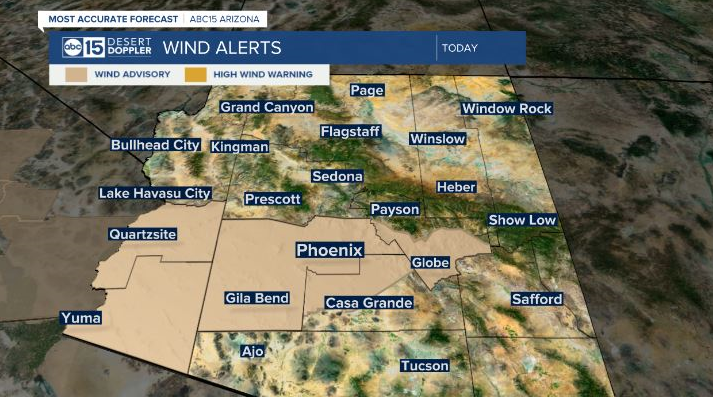
Winds are cranking up with this storm, too! Wind gusts could be as high as 40 mph here in the Valley and across northern Arizona. A Wind Advisory is now in effect for central and southwest Arizona, including Phoenix, through Monday.

All of the rain and snow is great news when it comes to drought conditions across Arizona and will most certainly make a difference in some parts of our state.
Right now, all of Arizona is in a drought and 73 percent of our state, including parts of the Phoenix metro area, is in Exceptional Drought (the worst kind).


