
PHOENIX — Windy conditions backing off heading into tonight and tomorrow before the winds pick up once again on Thursday around Arizona.
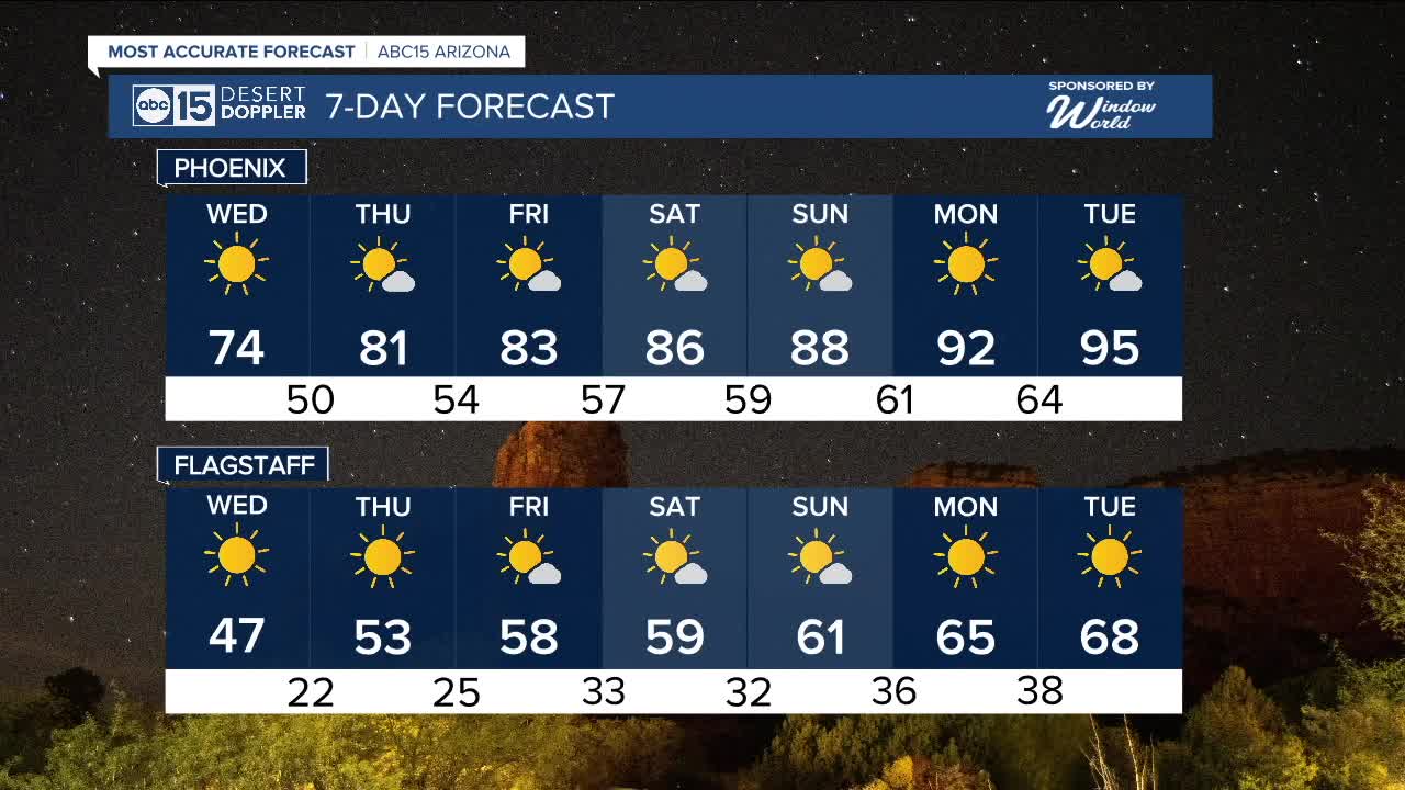
High pressure builds over our region starting tomorrow leading to dry and warmer conditions for the rest of the week.
The Spring Equinox happening Thursday at 2:01 am Arizona time, officially marking the start of Spring. It will be marked with mostly sunny skies and afternoon temperatures in the low 80s for the Valley.
With no rain in sight and another much stronger high pressure system moving in for the weekend, temperatures will stay well above normal.
By Monday the Valley has the potential to see highs back in the 90s and close to record temperatures.


2025 Sky Harbor Official Rainfall to date: 0.87" (-1.44" from average)
_________________________________________
2024 Sky Harbor Official Rainfall to date: 4.54" (-2.68" from average)
Monsoon 2024 Sky Harbor Official Rainfall: 0.74" (-1.69" from average)
__________________________________________
Daily rainfall reports from all across the Valley can be found here.
__________________________________________
PHOENIX IS GETTING DRIER - LOWER RAINFALL AVERAGES NOW
Average Monsoon Rainfall in Phoenix (1981-2010): 2.71" of rain
NEW Average Monsoon Rainfall in Phoenix (1991-2020): 2.43" of rain
Average Yearly Rainfall in Phoenix (1981-2010): 8:03" of rain
NEW Average Yearly Rainfall in Phoenix (1991-2020): 7.22" of rain
__________________________________________
Share your weather photos and videos with us anytime: share@abc15.com.
______________________________________
