



PHOENIX — Flooding along the Salt and Gila Rivers could last into the new week as SRP continues releasing water from dams upstream.
Flood Warnings remain in effect for parts of the Verde, Salt and Gila Rivers that run through the greater Phoenix Area and central Arizona. So, stay out of our local rivers and do not attempt to cross any flooded roadways.
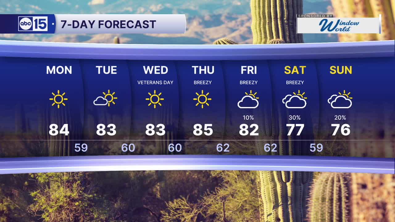
High pressure builds in this week, keeping things dry across Arizona.
Look for abundant sunshine and Valley highs in the low to mid 80s each day.
Overnight lows will cool into the 50s to low 60s each morning.
Our dry stretch will last for much of the week but we could see another atmospheric river set up across the western U.S. by late next week.
Rain chances will start going up across Arizona as early as Friday, and we could see Valley rain chances return by the weekend as our next storm system moves in.
Stay tuned for updates as we get closer.


2026 Sky Harbor Official Rainfall to date: 5.00" (-1.05" from average)
Monsoon 2026 Sky Harbor Official Rainfall: 2.46" (+0.03" from average)
__________________________________________
Daily rainfall reports from all across the Valley can be found here.
__________________________________________
PHOENIX IS GETTING DRIER - LOWER RAINFALL AVERAGES NOW
Average Monsoon Rainfall in Phoenix (1981-2010): 2.71" of rain
NEW Average Monsoon Rainfall in Phoenix (1991-2020): 2.43" of rain
Average Yearly Rainfall in Phoenix (1981-2010): 8:03" of rain
NEW Average Yearly Rainfall in Phoenix (1991-2020): 7.22" of rain
__________________________________________
Share your weather photos and videos with us anytime: share@abc15.com.
______________________________________
