High pressure is sending temperatures soaring and bringing unprecedented heat to Arizona for this time of year!
Our Excessive Heat Warning has been extended again, now in effect through 8 p.m. Tuesday for the immediate Phoenix Metro Area.

We remain in ABC15 Weather Action mode through Tuesday as a reminder to take action to stay safe in these dangerously hot temperatures. Stay hydrated, limit time outside in the afternoon hours and never leave kids or pets in the car no matter how quick the errand.

This heat wave has been shattering records since late September!
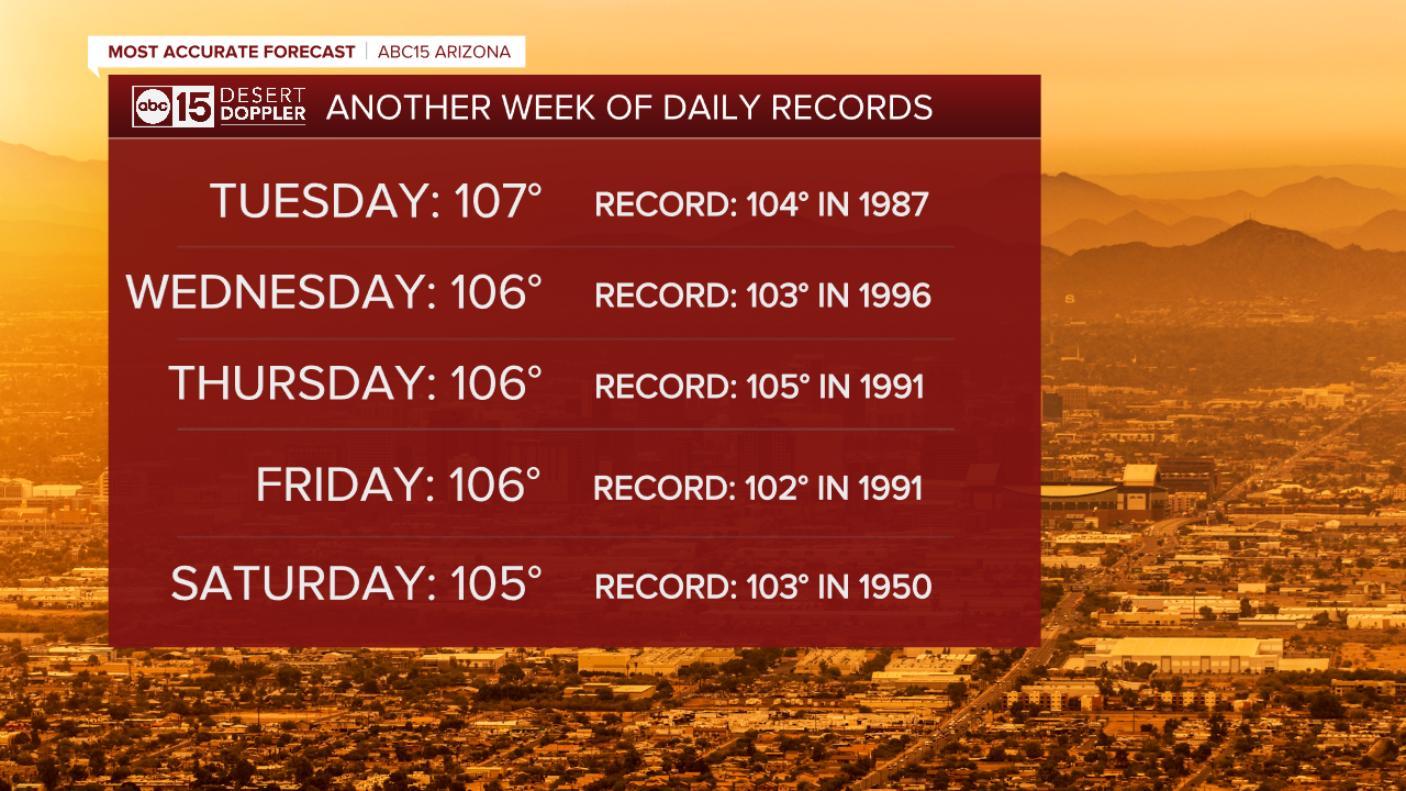
Valley temperatures will continue top out between 107 and 110 degrees into early next week. Average highs, which are considered "normal" for this time of year, are in the mid 90s.
The hottest temperature ever recorded in Phoenix in the month of October was 107 degrees, but we just broke that record to start the month. Sky Harbor hit 113 degrees on October 1st and October 6th, marking the new hottest October days ever. October 7th marked the latest day on record at 110 degrees or more.
We will continue to break more daily heat records in Phoenix in the days ahead and not just by a degree or two.

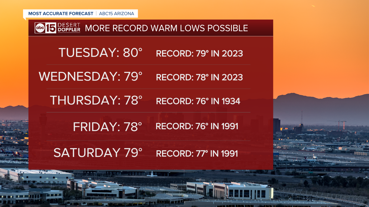
Since our nights are getting longer, we do not anticipate any 90-degree lows. Overnight temperatures will drop into the low 80s across the Valley, but that's exceptionally warm for this time of year and we could set new daily record warm lows too.

Phoenix also just set a new record warm low temperature for the month of October. Sky Harbor only dropped to 86 degrees Wednesday morning, breaking the daily record of 83 set in 1997 and the new record warm low for the month of 84 degrees which we just set on Tuesday morning.
Temperatures will drop gradually this week, but highs could still be record-setting until this weekend.
Right now, it's not looking like Phoenix will drop out of the triple digits until perhaps the week of October 14th.
As ocean temperatures cool near the equator in the eastern Pacific, we are transitioning toward a winter La Niña. That will force the jet stream (which is our steering wheel for storms in the upper atmosphere) farther north, which typically means a warmer and drier fall and winter for Arizona.

The latest outlooks from the Climate Prediction Center shows odds favoring just that as we head toward winter: warmer and drier.


